Cities in Macedonia – North Macedonia
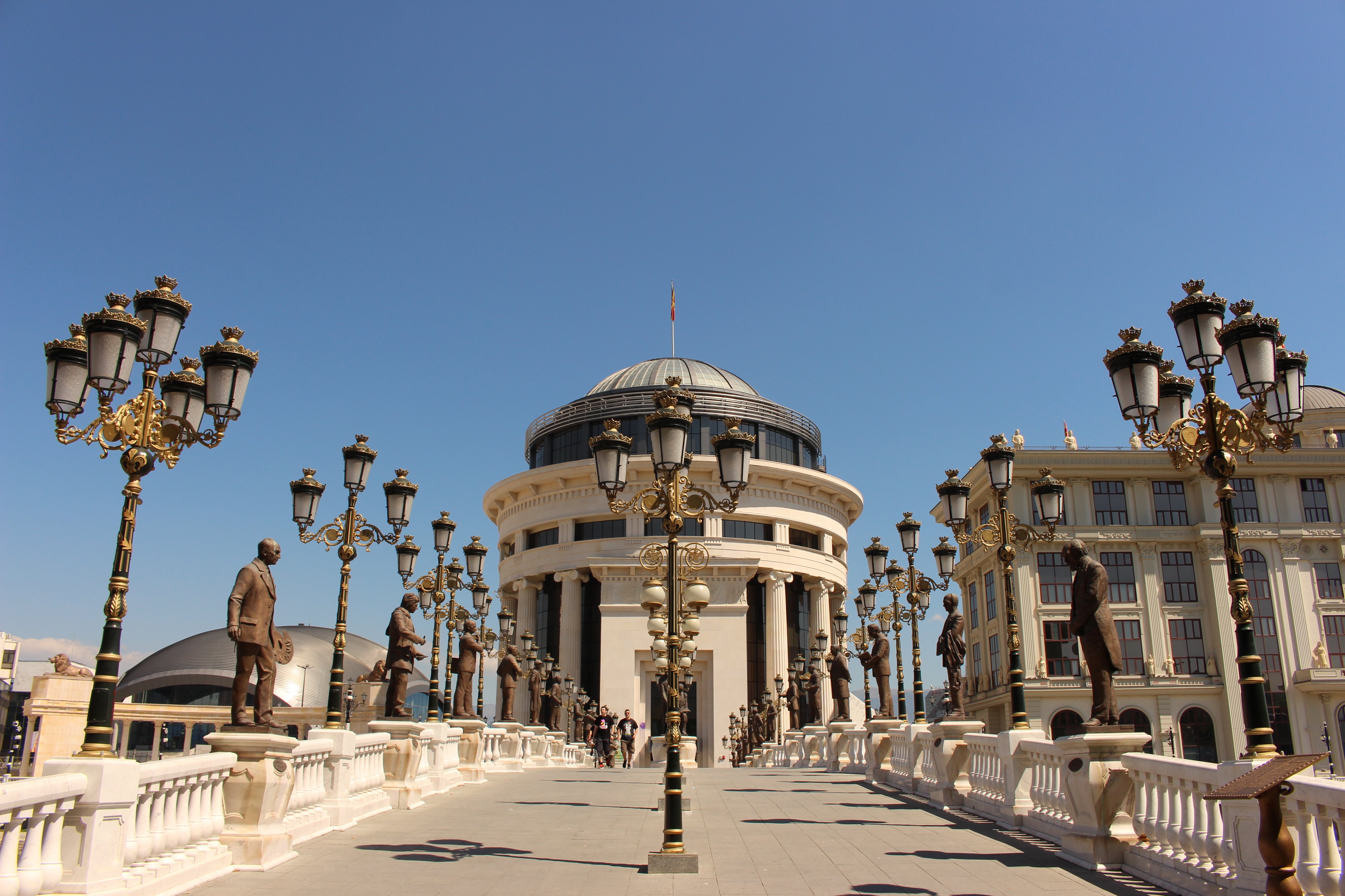
Skopje is the capital and the largest city of the Republic of Macedonia – North Macedonia. It is the country,s political, cultural, economic, and academic center.
Skopje’s individuality is displayed in its topographic position. More than a “Capital”, “first city”, “center” Skopje is also a “Capita” (“head”).
Seven roads lead to and from Skopje, all of which are narrow passages or gorges, entries that seem to have been carved by a giant’s hand. The seven roads are very similar to seven perception and vital accesses to and from the head of the human. The capital of the soul, consciousness, or the personality of every human, is situated in the personal cave called the head. The seven paths leading to and from the head are as follows: the eyes, ears, nostrils, and mouth! Five of them are wide open, and the city sees, listens, breathes and talks through them. Two (the ears) are concealed in secret corridors. Everyone who passes along these roads will be able t see with the eyes of Skopje, listen with the ears of Skopje, breathe with the breath of Skopje and understand the speech of Skopje!
The geo-mythological legend on the genesis of Skopje is the only one of its kind in the entire world urban history. It is only the splendor of the chthonic net woven of unparalleled parables and metaphors that may be weighted against Skopje’s thematic exclusivity! Once at the location where the city is today, there was an enormous head but without a single opening. Everybody simply called it “The Head’. It has not been identified when did it happen that a certain evil magician had cursed The Head to remain sealed: blind, deaf, mute. It was many years after that when a big hero came armed with a huge spear. As soon as he had defeated the magician, with his spear, he opened all the seven roads in the bewitched head. That was the way the eyes were created, by means of which the head became capable of seeing: Kačanička Klisura gorge and Matka/Treska Gorge, with the Lepenec and Treska rivers; the nostrils: Raduški Derven ravine, Grupčinski Derven ravine (Žeden mountain, which divides the eyes and joins the nostrils, is the nose, and its name comes from the fact that water only flows out from it but does not flow in, which is the reason why all noses are always thirsty!); the ears: Kitka mountain saddle and Matejče saddle passes through mountains, hidden like the ear canals in the head: the mouth: Taorska Klisura gorge on the river Vardar. As the head was revived, its body woke up, too. It enquired of the hero to tell how he had managed to release it from the spell. He showed his great spear that opened all seven paths. At that instant, seven winds began blowing through all the seven access roads to the city. The spear driven into the earth started clanging, chanting. Ever since then, the city has been called the city freed With -a-Singing- Spear (So-Kopje-Koe-Pee)! Later on, the shorter name Skopje was derived from that form, and all letters from the older name have been retained in the present name – Skopje.
Lake Ohrid and the city of Ohrid are located in the south-western part of the Republic of Macedonia – North Macedonia. Ohrid is a city-museum and a cultural treasury of Macedonia – North Macedonia. The Lake Ohrid is known as one of the world’s deepest (321 meters) and one of the 10 clearest lakes in the world, with a transparency of 27 m. Due to the great variety of flora and fauna, most of which endemic species, Ohrid Lake was inhabited even in prehistoric times. The ancient Lihnidos, whose fortress is mentioned for the first time by the historian Livius, way back in the third century B.C. According to explorers, this is where the apostle Paul has resided on his journey dedicated to teaching and spreading the faith in Christ. Ohrid is the center of Christianity for all Slavs, an archbishopric seat, a seat of schools and universities, the first ones in this region, and even further. Today Ohrid remains a center of archaeological sites and discoveries. Ohrid is the city of 365 churches. One church for each day of the year. In Biblical Macedonia, every path leads to Ohrid. The person coming to Ohrid is at first amazed, and afterward, deep within his soul, bows to its marks, which simply encourage you to understand or maybe to wonder – why certain places have been chosen to be different, praised and unique in the whole world. The sky above Ohrid Lake, which is very bright and crystal blue, is a confirmation of the antique name of the city of Ohrid – Lychnidos, i.e. the city of light.
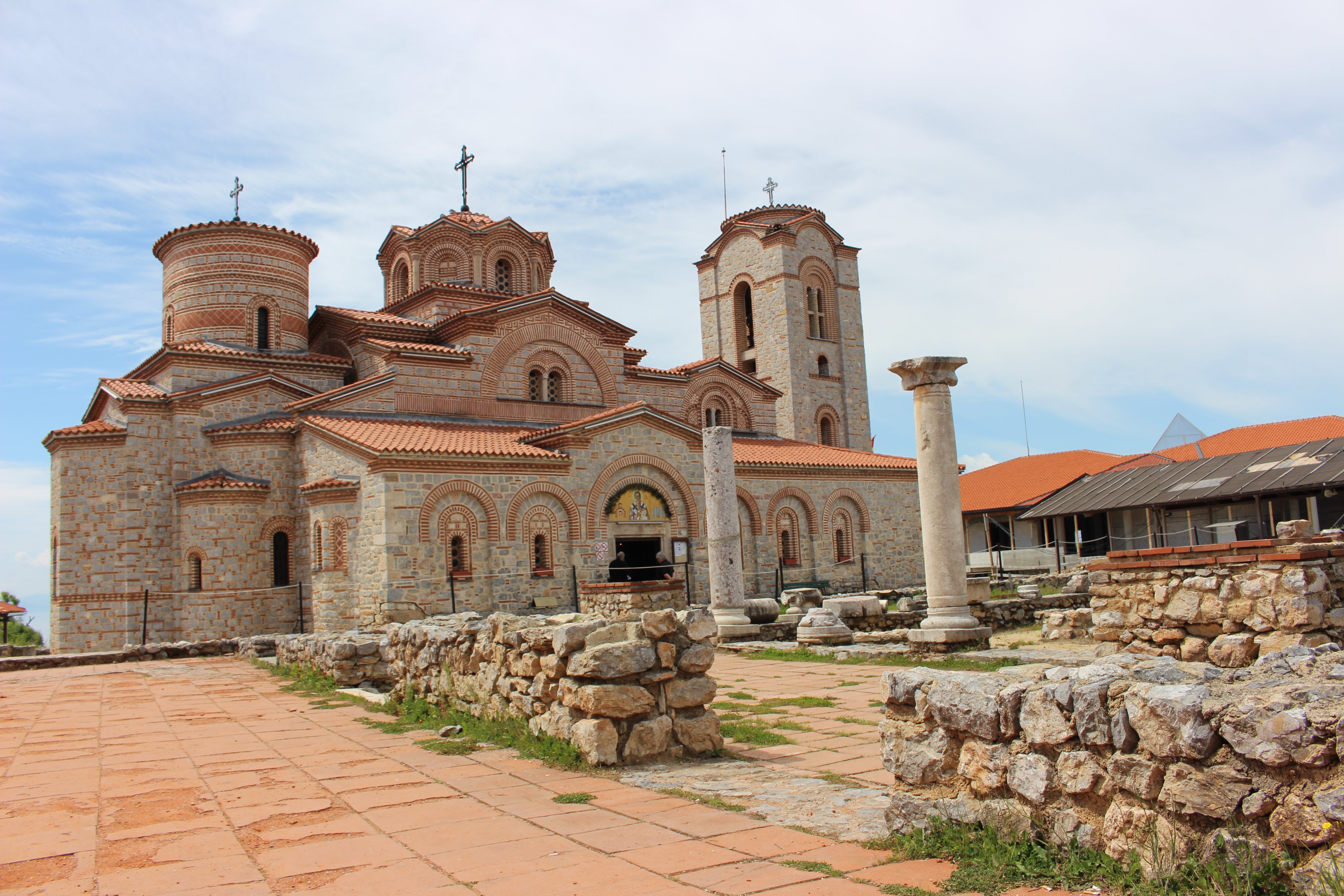
Bitola is the second largest city in the Republic of Macedonia – North Macedonia. It is situated in the utmost southwestern part of Macedonia – North Macedonia in the Valley of Pelagonia in the foothills of Baba Mountain. It is only 13 kilometers from the border with Greece. Bitola is dispersed along the banks of the River Dragor at an altitude of 590 to 700 meters above sea level.
Bitola was founded by the Slavs, i.e by the tribe called Dragoviti at the end of the sixth century. As an urban settlement it is mentioned for the first time in the eleventh century. The city has evolved in the immediate vicinity of the former ancient town Heraclea ( which is 2 kilometers away to the south of today’s Bitola). This settlement was a commercial, cultural and traffic center for southern Pelagonija. In the Middle Ages Period it was a settlement with diverse positions, functions, and roles, evolving from a medieval fortified place to a place with churches and monasteries, an Episcopal seat, an ecclesiastical seat, etc.
In the 18th century, Bitola witnessed a certain decline, but it restored its functions in the 19th century when it experienced a territorial expansion. Simultaneously the city became the City of Consuls, since in the second half of the 19th century until 1912, several consulates were located in Bitola, such as the Austro-Hungarian, Russian, Greek, Serbian, Romanian, Italian and the Bulgarian Trade Agency. Following the Balkan Wars and the division of Macedonia – North Macedonia, as well as following the First and Second World War, Bitola lost a major part of its commercial, administrative-political, cultural and other functions.
Bitola nowadays is the second most modern, economic, administrative- political and cultural-educational center in Macedonia – North Macedonia.
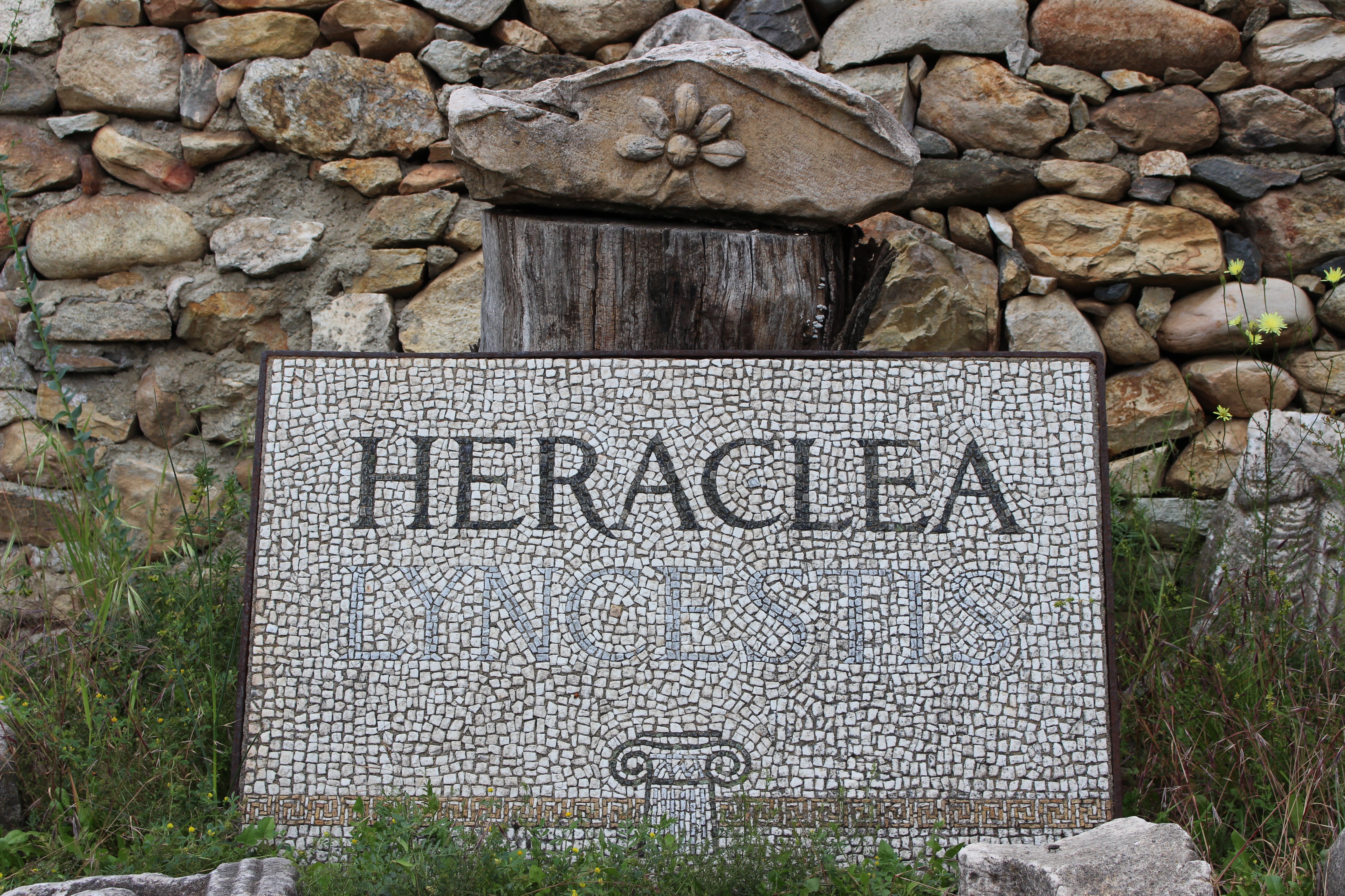
In the foothills of Mountain Baba, in the vicinity of Bitola, lies the ancient town founded in the fourth century BC- Heraclea Lyncestic, the beauty and attractiveness of which withes its perseverance and superiority with the passage of time. The name Heraclea derives from the name of Heracles, a mythological hero and a founder of the Macedonian Royal Dynasty Argeady, whereas the epithet Lyncestic derives from the name of the region Lyncestic. It is assumed that the town was founded by the Macedonian Czar Phillip II of Macedon.
The architecture of Bitola dwells on the centuries-old preserved solutions cherished by the building script, with beautiful and lavishly adorned wooden balconies, deeply indented verandahs, wood coated eaves, the wooden and aesthetic casings, usage of rich ornaments, etc.
The Clock Tower is located in the city center of Bitola, in the northern part of Shirok Sokak.
Shirok Sokak is the main street in Bitola, from where all the urbanists, builders and other planners have started when major buildings were to have been constructed, taking into account its lines.
Every year on the eve of August 2nd– the Day of the Ilinden Uprising, the festival “Ilindenski Denovi” is held. The authentic folk dances and songs of both the Macedonian people and the people worldwide are promoted at this festival.
Among other cultural happenings talking lace in Bitola are the International Children’s Artistic Colony “Small Monmartre of Bitola”.
Kumanovo is the third largest city in Macedonia – North Macedonia located in the northern part of Macedonia – North Macedonia. It is situated in the eastern foothills of Skopska Crna Gora, in the eastern part of Kumanovo Field at an altitude of 350m. According to the legend, the name f this town derives from the name of the warrior’s tribe called Kumani. It is assumed that Kumanovo was founded in the twelfth century for the purpose of safeguarding the crossing between the rivers the Vardar and Juzhna Morava. In the Turkish documents which date back to 1519, it is mentioned as a village within the district in the Turkish administration called Negorichka with a total of 52 families and circa 300 inhabitants.
The highway which leads through this part of Macedonia – North Macedonia connects Kumanovo with Kyustendil in the Republic of Bulgaria, as well as the railway which passes through the city and connects Skopje with Belgrade in Serbia. Today, Kumanovo is a significant cultural, educational, and economic center with the industry mostly concentrated on small cobbler’s private factories.
If you visit Kumanovo, you should definitely visit the village Staro Nagorichane. In the village lies one of the most significant monuments of Macedonian culture, the church dedicated to St.George. According to the text found in the church, its construction was in 1313 but it was built on the foundations of an older sacred building dating back to the 11th century. Only facade walls in stone block forms and a small fragment from the painting are preserved. The church is a three-nave building and it has a form of inscribed lengthen cross covered by five domes. The church is extraordinary because of the original altar partition i.e. the iconostasis is made by stone pillars, blocks and ornamented architrave.
Kokino is a Bronze Age archeological site approximately 30 km from Kumanovo in the municipality of Staro Nagorichane. Kokino is among the most valuable ancient observatories in the world. The American Space Agency NASA ranged this observatory on the fourth place from the list with 15 observatories of this type worldwide; it is after Abu Simbel in Egypt, Stone Hedge in Great Britain and Angkor in Cambodia.
The observatory is located onto two scale platforms, where planets were observed. Traces of some objects and pieces of ceramics were found on the upper platform. Probably some tribe members had an everyday task to follow the movement of the heavenly bodies and to create calendars in order to determine the days for rituals, as well as those calendars, were used to start with season work in agriculture and cattle breeding.
One of the most noteworthy events in Kumanovo is the International Jazz Festival held in the period of July and August.
In October is held the International Theatrical Festival- Days of Comedy.
In July and August, the Multimedia Center Krapino near Kumanovo organizes Art Colony.
If you want to feel the real sense of Kumanovo you must try mezal’k (a traditional dish) and sudzuk (a kind of thick dried sausage made of beef/mutton.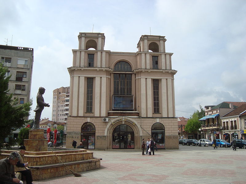
Prilep –City under the Markovi Kuli and Selechka Mountain. Located in the central part of the southern region of Macedonia – North Macedonia at an altitude of 620-650 meters and on hilly slopes up to 680 meters.
As a fortified place and a military point, it is mentioned in the time of Czar Samuel. At the beginning of the eleventh century, the Byzantine Emperor Basil II named it Prilapon. The city was referred to us both Prilapos and Prilepon. Upon falling under Byzantine ruling in the year 1018, the city started moving in the direction of today’s suburb Varosh, where the Byzantine town Prilep was established. In the thirteen century, Prilep was the capital of Dushan’s parish priest Volkashin. After his death ( in the Battle of Marica in the year 1371), the city was governed by his son Krali Marko, who was the last Macedonian king. The fortress Markovi Kuli raising on the hill above Prilep was named after him.
The Clock Tower is from 19th century, 38.5 meters high and has been proclaimed a monument of culture. The Burial Mound of the Invincible in the Park of the Revolution is a colossal monument of the fighters on 11th October 1941.
Today Prilep is known as the city of tobacco. The primary feature of the economy of Prilep is tobacco production. Hence, Prilep is the most developed tobacco centar in Macedonia – North Macedonia. The exploitation of non-metal raw materials and marble for various marble products is typical of Prilep and the area of Prilep.
Recently was discovered Marble Lake – Macedonian Pamukkale. Small turquoise color lake in the abandoned marble mine above the village Belovodica. Place worth visiting.
One of the most famous happenings in Prilep in July is Pivo Fest ( Beer Festival). The festival is open air festival offering different types of cold beer, delicious and famous Prilep’s minced meat barbeque and popular stars from the region.
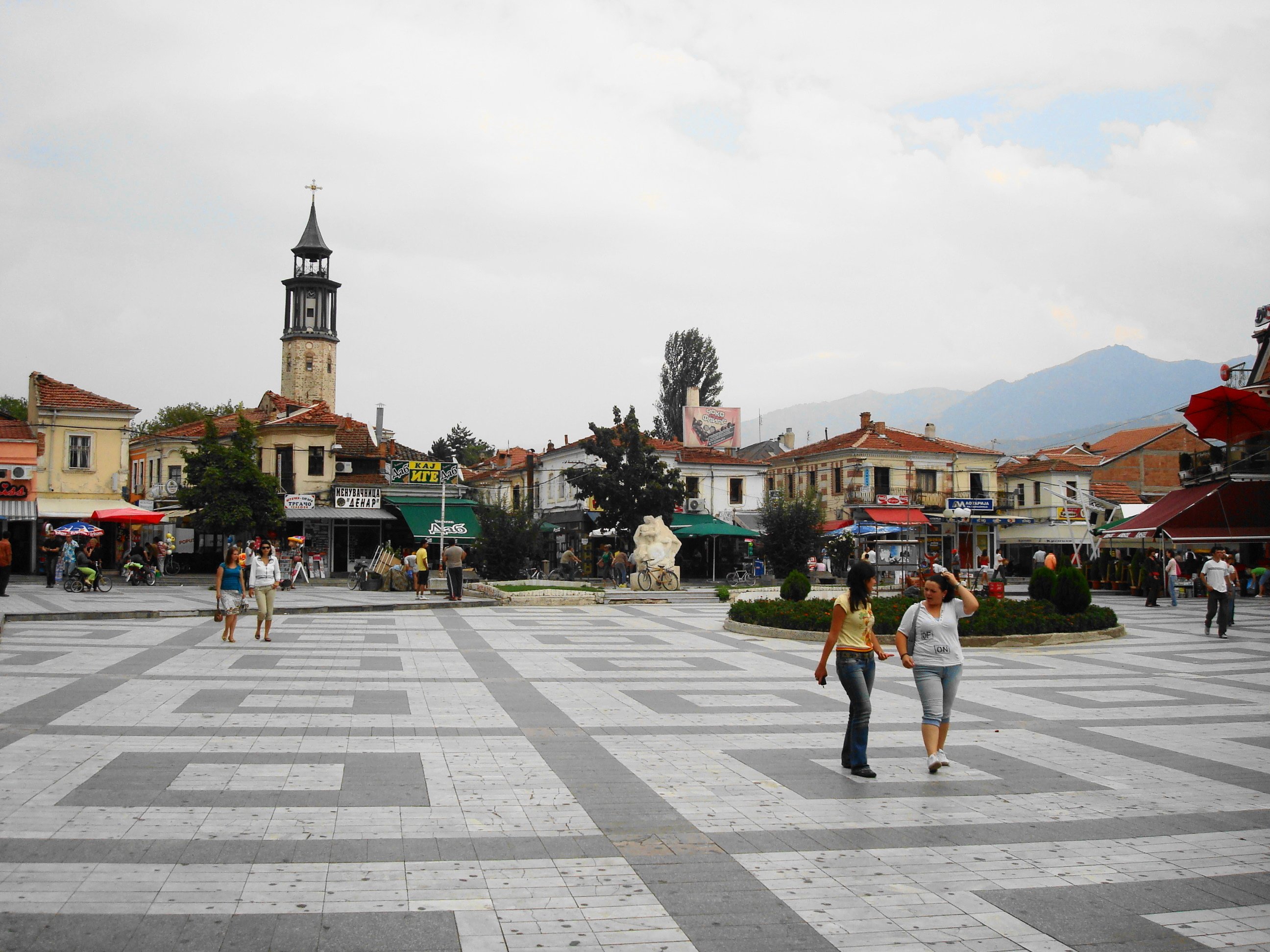
Tetovo is located in the north-western part of Macedonia – North Macedonia in the foothills of Shar Planina (Shar Mountain) at an elevation ranging from 450 to 500 meters. Most of the city lies in the flatland area, whereas the older part of the city is spread on the hill called Beltepe (806m).
It is mentioned for the first time in the thirteen century as a village ( under the name Htetovo), which does not imply that the settlement had not been established earlier. The earliest inhabited are of Tetovo was the part around the Monastery of the Mother of God of Tetovo.
At the beginning of the twentieth century, Tetovo was a remarkable center of trade and crafts and it was also famous for the production of quality apples. Following the Balkan Wars, the city experienced a population increase and it had a mixed ethnic structure. The genuine development of Tetovo (both in terms of population and economy) occurred following the Second World War when the city got contemporary features of an economic, administrative-political and cultural-educational center. As far as the economy of the city is concerned industry has a leading role, followed by agriculture, farming, trade, and tourism. Modern tourism has been present in Tetv since the 1930’s, when the genuine skiing, mountaineering and recreational opportunities on the slopes of Shar Mountain were perceived.
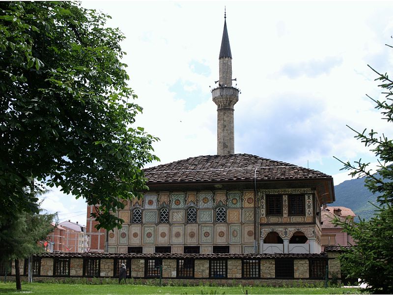
Traveling to Tetovo you must visit the impressive citadel built in 1820 by the Abdurahman Pasha, the Painted Mosque built in 1495, Arabati- Baba Teke- a complex of religious buildings grouped around the grave of Sersem Ali-Baba.
The Complex of Leshok Monastery encompasses the Monastery Church of St. Atanasij which was built in the year 1335 by the clergyman Atanasij. The Church of the Holy Mother of God is also located within the complex. The grave and the memorial room of Kiril (Cyril) Pejchnikovik, one of the most prominent Macedonian reformers, are within the monastery complex.
Gevgelija is located in the very south of Macedonia – North Macedonia in the valley of Gevgelija and Valandovo at the elevation of 60 meters. Gevgelija as a border town has a favorable transportation and geographic position. Gevgelija experienced a rapid economic development and growth in the mid-nineteenth century upon the construction of the railway line Skopje- Thessalonica in the year 1877, when the number of inhabitants reached beyond 2,000, in 1953 the number of inhabitants was approximately 6,000, whereas in 2002 it was circa 15,000. Alongside the population, Gevgelija developed economically, particularly in agriculture, industry, trade, and tourism.
Nowadays, Gevgelija is a contemporary border town with the entire required town functions, towards which 33 rural settlements from the surroundings gravitate.
The surroundings of Gevgelija are rich in spring an mineral and thermos-mineral water. One of the most distinguished and most popular springs of mineral water is located in the tourist locality known as Smrdliva voda on Kozhuf Mountain, 24 kilometers from Gevgelija. In the foothills of Kozhuf lies Negorska Spa with springs of thermo-mineral water.
